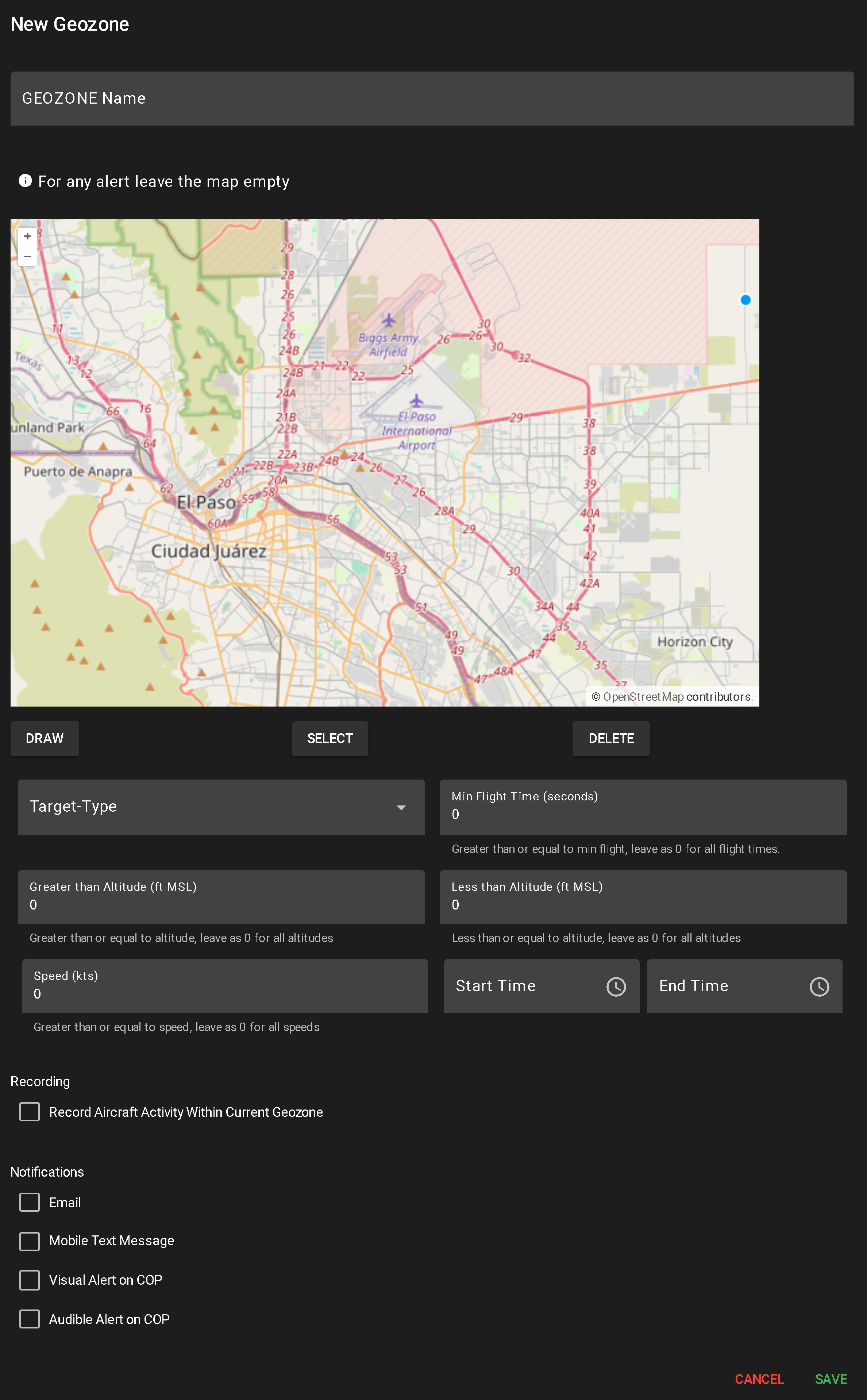
Radar Geozone
A Radar Geozone Alert monitors objects detected via radar—including UAS, birds, and crewed aircraft—based on configurable flight parameters and time of activity. These alerts are useful for identifying anomalous radar behavior within a geofenced area.
To create a new alert, click NEW RADAR GEOZONE.
This opens a configuration popup for alert setup:
- Enter Geozone Name
- A required field used to identify the alert in the system.
- Draw Geographic Area (Optional)
- Use the DRAW tool to define the monitoring area:
- Click to create each segment
- Double-click or click the origin to complete the shape (minimum two segments required)
- Multiple shapes can be drawn
- Leaving the map blank applies the alert system-wide
- To delete a shape, click SELECT, highlight the shape, and click DELETE.
- Toggle Camera Recording
- Check or uncheck “Record Aircraft Activity Within Current Geozone” to enable/disable video capture when the alert triggers.
- Configure Notification Methods
- Select any combination of the following to determine how alerts are delivered:
- Mobile Text Message
- Visual Alert on COP
- Audible Alert on COP
- Input Radar Alert Conditions
- Target Type – Required. Select one or more: UAS, Bird, Fixed Wing, Rotary Wing
- Min Flight Time (seconds) – Minimum time airborne. 0 = all durations
- Greater Than Altitude (ft AGL) – Minimum altitude to trigger. 0 = all altitudes
- Less Than Altitude (ft AGL) – Maximum altitude to trigger. 0 = all altitudes
- Speed (kts) – Minimum speed to trigger. 0 = all speeds
- Start Time / End Time – Required. Define the time window during which the aircraft must be active (24-hour format)
- Save or Cancel
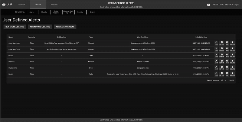
When a user clicks the Report button for a user-defined alert, a popup table appears displaying all flights that have triggered that alert. The layout and functionality are similar to Flight History (see more about Flight History).
Report Table Columns
Filtering & Search Options