Flight History
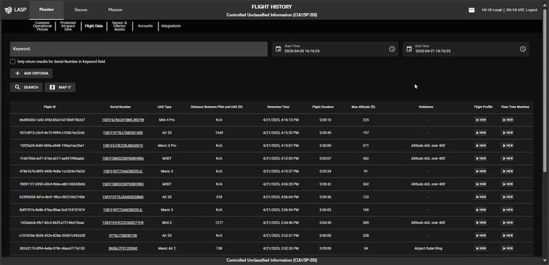
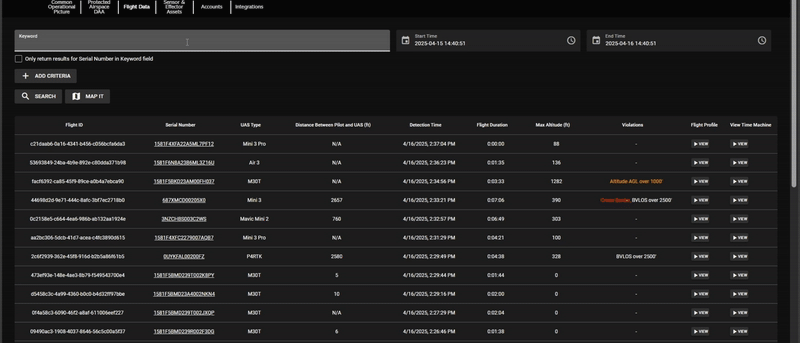
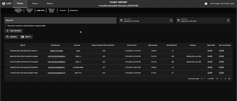
The Flight History page provides a log of all UAS flights captured from cooperative hardware. Users can search, filter, and analyze flights based on aircraft type, serial number, altitude, violations, and other key parameters.
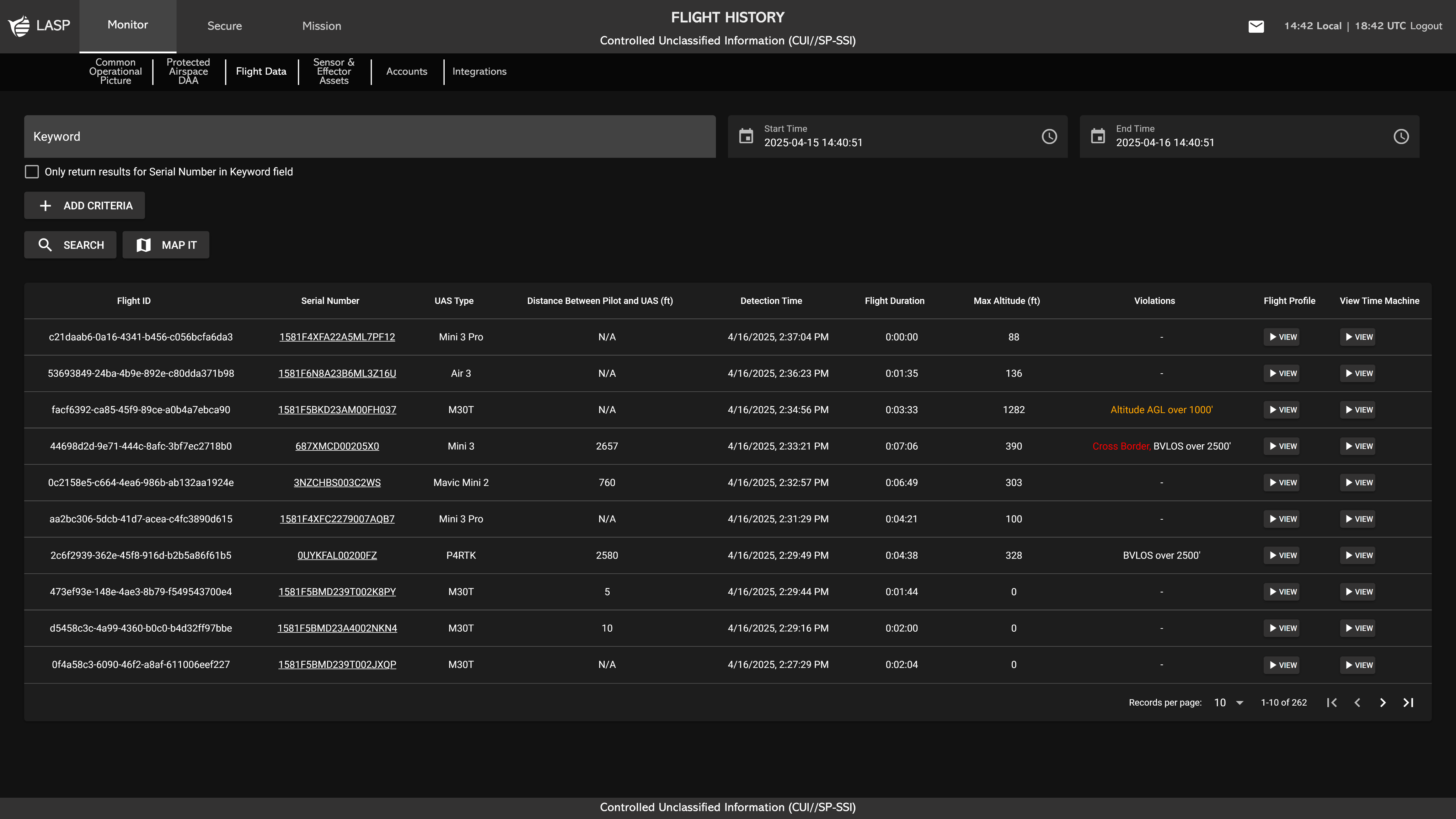
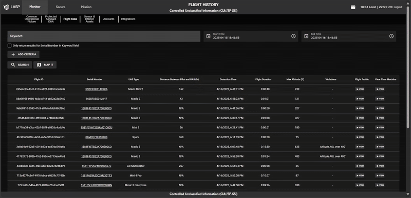
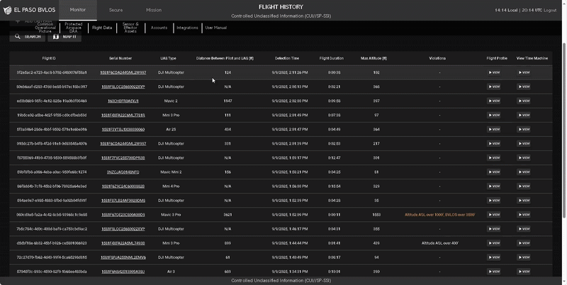
Users can search for flights by entering keywords such as aircraft type, serial number, or time of day in the search bar.
To refine search results, users can apply additional filters:
- Enter a keyword in the search bar.
-
Click ADD CRITERIA
 to add a new filter. This action will generate an input
dropdown field labeled Criteria Type, allowing users to
select from the following options:
to add a new filter. This action will generate an input
dropdown field labeled Criteria Type, allowing users to
select from the following options:
- Flight Duration (s) – Filter by total flight duration.
- Max Altitude (ft) – Show flights based on their highest altitude.
- Detection Time – Filter flights by detection timestamp.
- Distance Between Pilot and UAS (ft) – Show flights based on proximity to the pilot.
- Violation Severity – Display flights based on violation severity.
- Specific Violation – Search for flights linked to a specific infraction.
- Filter by Serial Number (Optional) – Select “Only return results for Serial Number in Keyword field” to limit the search to flights matching a specific serial number.

After a Criteria is applied, it will appear in the active search criteria section.
-
To remove a Criteria, click REMOVE
 next to the respective Criteria. This will instantly
update the search results to reflect the removal of that
filter.
next to the respective Criteria. This will instantly
update the search results to reflect the removal of that
filter.
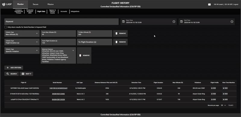
Clicking a Serial Number in the Flight History table applies a filter that updates the table to show only flight logs for that specific Serial Number. To remove the filter and return to displaying all drone flights, users can click "SHOW ALL DRONE FLIGHTS".
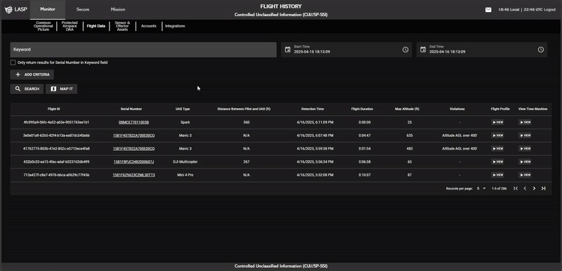
Filtering by Start Time and End Time
Users can define a time range by entering a Start Time and End Time:
-
Start Time – Click the Calendar icon
 to select a date and the Clock icon
 to set a time.
- End Time – Follow the same process to define the range's endpoint.
Once both Start Time and End Time are set, users must click SEARCH
 to apply the selected time range. This action updates the Flight
History table, displaying only flight logs that fall within the
specified period.
to apply the selected time range. This action updates the Flight
History table, displaying only flight logs that fall within the
specified period.
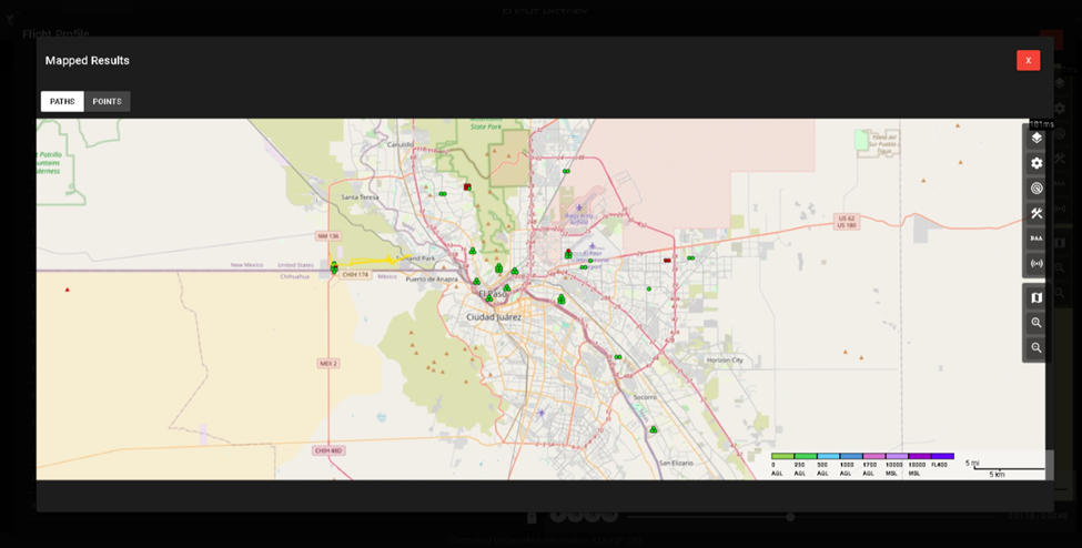
Search results are displayed in a table format and can be viewed in multiple ways. Users can interact with the data using the MAP IT to display aircraft flight paths or detection points.
Visualizing Flight Data on a Map
Click MAP IT to open a map displaying aircraft flight paths or detection
points. Users can choose between:
to open a map displaying aircraft flight paths or detection
points. Users can choose between:
- Paths – Displays the full flight trajectory of each aircraft in the table.
- Points – Marks specific locations where sensors detected the aircraft.
This feature allows users to analyze flight movement patterns and sensor tracking in real time.
Users can review detailed flight violations by clicking VIEW
 under the Flight Profile column.
This action opens a
popup divided into two sections:
- Left Side – Displays a table listing the selected drone's past violations.
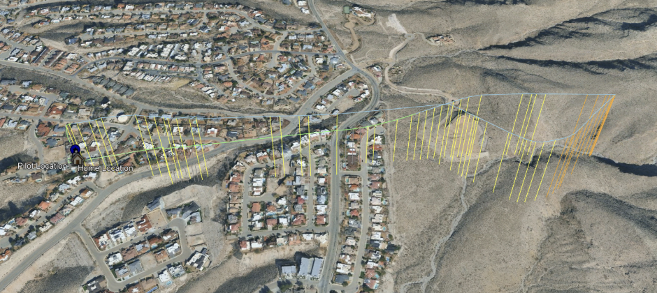
- Right Side – Displays a map that visually represents the drone’s recorded flight path for the selected Flight Profile/Flight Violation.
The table provides a detailed history of the aircraft’s violations, including:
- Recorded flight data – Displays key flight parameters and historical data.
- Violation severity levels – Indicates the severity of detected violations.
- Detection timestamps – Shows when the violations occurred.
-
Flight Profile – Clicking VIEW
in a row updates the map on the right side to display that
specific flight violation.
Viewing Violations on a Map
To visualize violations on a map, click “VIEW ON MAP”. The aircraft’s violations will be displayed as:
- Paths – Full flight trajectory.
- Points – Individual detection events.
Viewing Flights in Google Earth
To visualize a flights path in Google Earth, click “DOWNLOAD KML”. The aircraft’s flight path will be displayed as:
- Flight Path – Full flight path trajectory.
- Flight Altitude Points – Individual points with altitude.
- Flight Violations – Corresponds with the flight altitude point.
- Origin Point – First capture point.
- Pilot Location – Pilots origin point.
- Home Locations – Home origin point.
The map on the right contains an expandable flight profile section, similar to the one displayed in the COP Map (more on Common Operational Picture (COP)). It also includes a map toolbar similar to the one described in Map Tool Bar.
Users can control the video feed located at the bottom of the map with the following options:
- Play/Pause
- Toggle playback of the recorded flight.
- 1X, 5X, 30X – Adjust playback speed.
- Timeline Bar – Manually scrub through the flight recording to analyze specific moments.
Users can replay a past flight within the COP Time Machine
by following these steps: