Manned Geozone
A Manned Geozone Alert monitors crewed aircraft (e.g., helicopters, airplanes) operating within a designated area. These alerts are helpful for tracking aircraft that may pose a risk to sensitive operations or restricted zones based on speed, altitude, or registration.
To create a new alert, click NEW MANNED GEOZONE.
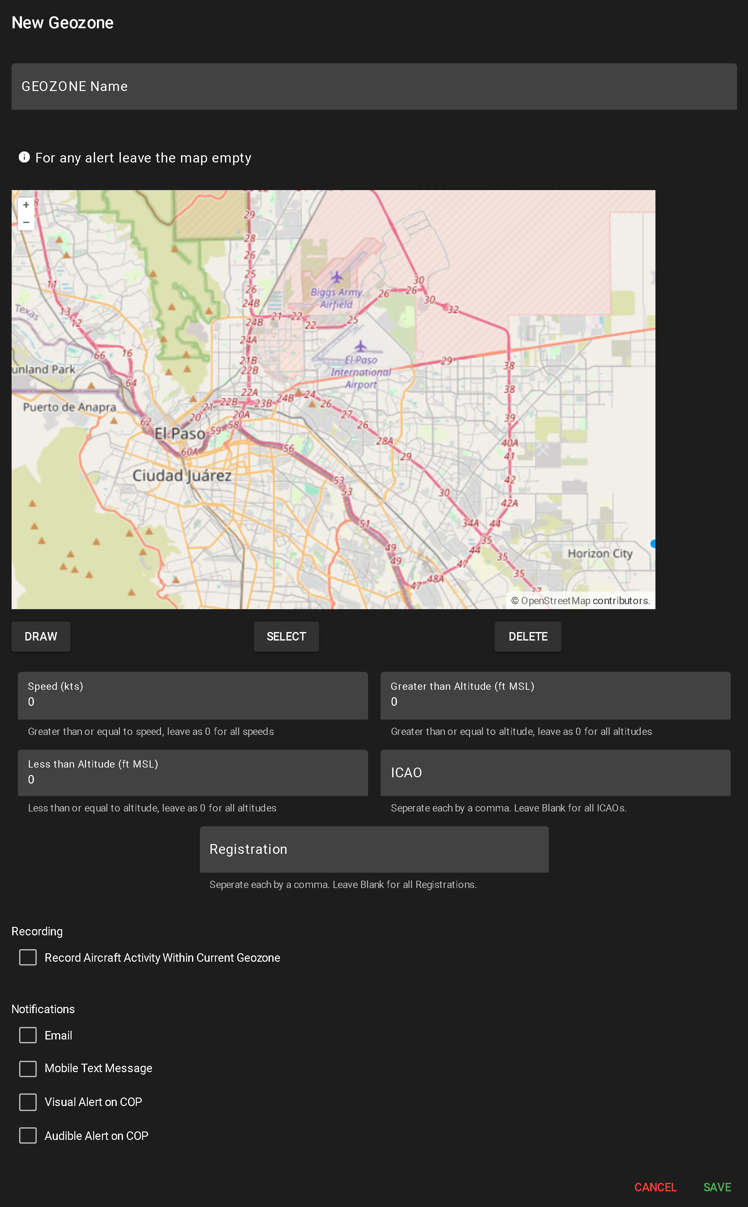
This opens a configuration popup for alert setup:
- Enter Geozone Name
- A required field used to identify the alert in the system.
- Draw Geographic Area (Optional)
- Use the DRAW tool to define the monitoring area:
- Click to create each segment
- Double-click or click the origin to complete the shape (minimum two segments required)
- Multiple shapes can be drawn
- Leaving the map blank applies the alert system-wide
- To delete a shape, click SELECT, highlight the shape, and click DELETE.
- Toggle Camera Recording
- Check or uncheck “Record Aircraft Activity Within Current Geozone” to enable/disable video capture when the alert triggers.
- Configure Notification Methods
- Select any combination of the following to determine how alerts are delivered:
- Mobile Text Message
- Visual Alert on COP
- Audible Alert on COP
- Input Manned Alert Conditions
- Speed (kts) – Minimum speed to trigger. 0 = all speeds
- Greater Than Altitude (ft AGL) – Minimum altitude to trigger. 0 = all altitudes
- Less Than Altitude (ft AGL) – Maximum altitude to trigger. 0 = all altitudes
- ICAO – Comma-separated list of ICAO identifiers. Leave blank for all
- Registration – Comma-separated list of registration numbers. Leave blank for all
- Save or Cancel
When a user clicks the Report button for a user-defined alert, a popup table appears displaying all flights that have triggered that alert. The layout and functionality are similar to Flight History (see more about Flight History).
Report Table Columns
Filtering & Search Options