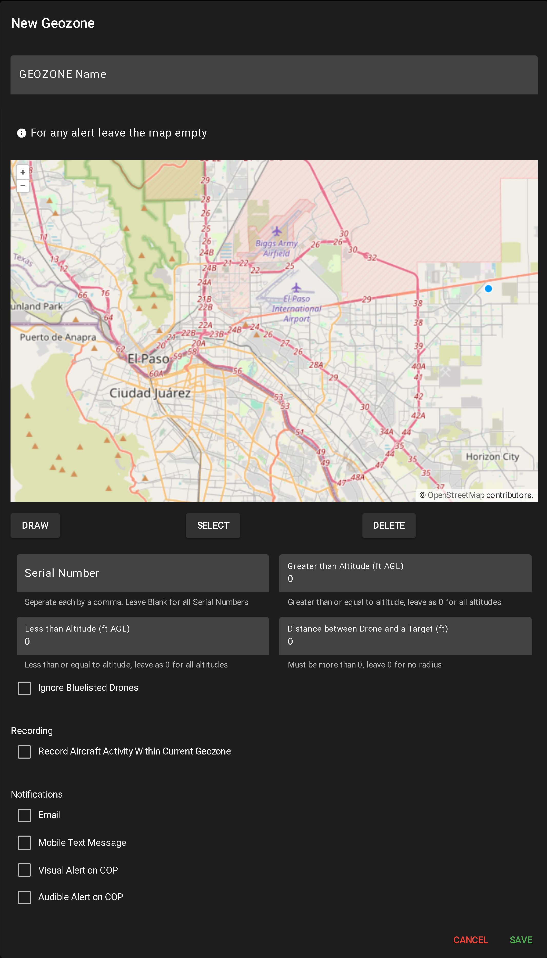
UAS Geozone
A UAS Geozone Alert is used to monitor unmanned aircraft systems (UAS) that meet specific conditions such as altitude, proximity to targets, or serial number. These alerts help identify potentially unauthorized or high-risk drone activity in a designated area.
To create a new alert, click NEW UAS GEOZONE.

This opens a configuration popup for alert setup:
- Enter Geozone Name
- A required field used to identify the alert in the system.
- Draw Geographic Area (Optional)
- Use the DRAW tool to define the monitoring area:
- Click to create each segment
- Double-click or click the origin to complete the shape (minimum two segments required)
- Multiple shapes can be drawn
- Leaving the map blank applies the alert system-wide
- To delete a shape, click SELECT, highlight the shape, and click DELETE.
- Toggle Camera Recording
- Check or uncheck “Record Aircraft Activity Within Current Geozone” to enable/disable video capture when the alert triggers.
- Configure Notification Methods
- Select any combination of the following to determine how alerts are delivered:
- Mobile Text Message
- Visual Alert on COP
- Audible Alert on COP
- Input Drone Alert Conditions
- Serial Number – Comma-separated values (e.g., 123,456,789). Leave blank for all drones.
- Greater Than Altitude (ft AGL) – Minimum altitude to trigger. 0 = all altitudes
- Less Than Altitude (ft AGL) – Maximum altitude to trigger. 0 = all altitudes
- Distance Between Drone and Target (ft) – Minimum distance to trigger. 0 = all distances
- Ignore Bluelist – Check to exclude known or authorized drones from triggering the alert
- Save or Cancel
When a user clicks the Report button for a user-defined alert, a popup table appears displaying all flights that have triggered that alert. The layout and functionality are similar to Flight History (see more about Flight History).
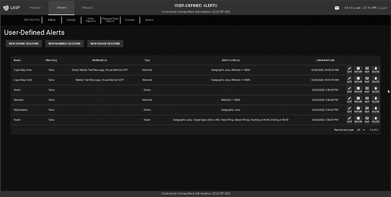
Report Table Columns
Filtering & Search Options