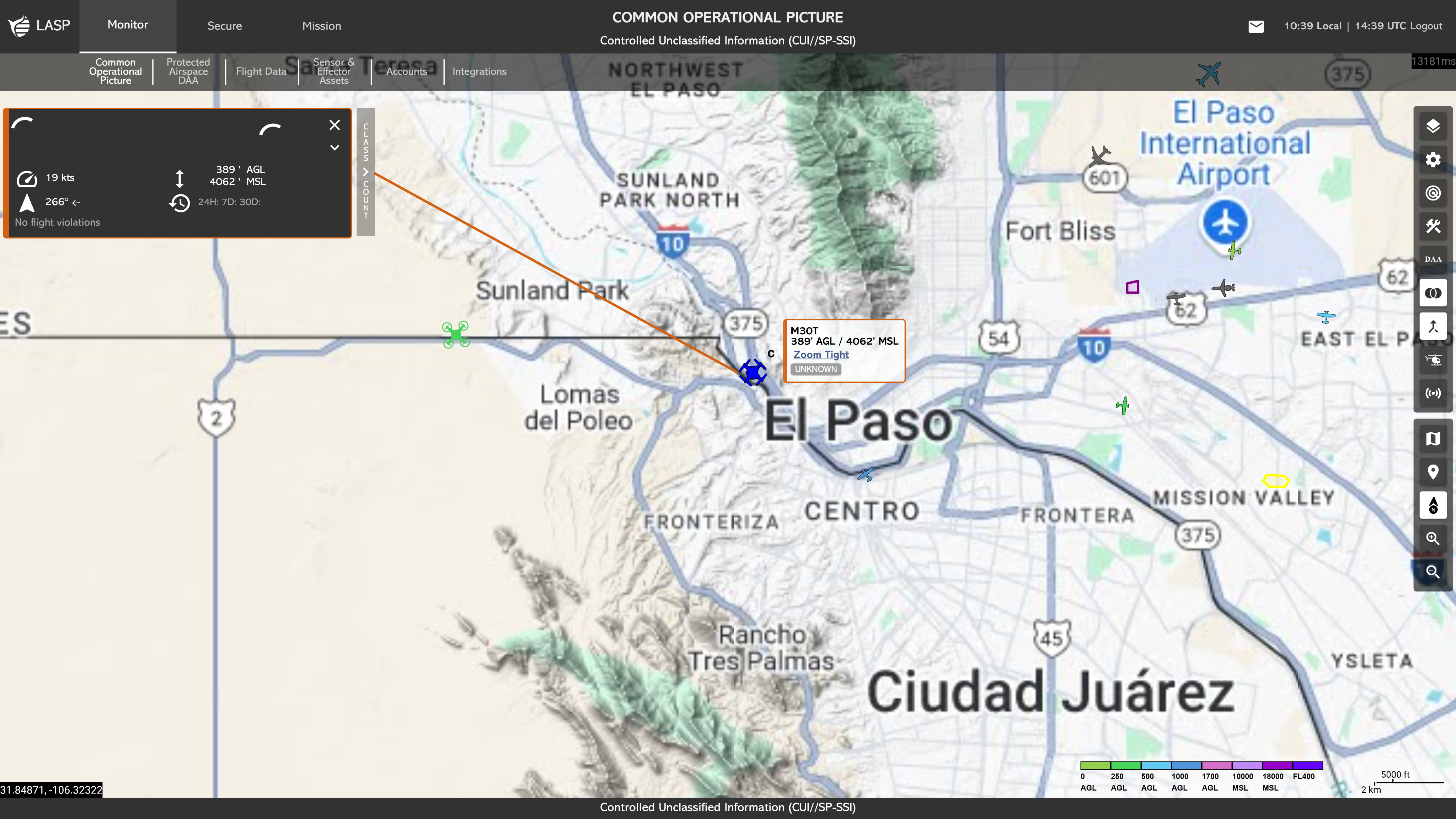
Aircraft Tracks
The COP displays both crewed and uncrewed aircraft tracks
on the map displays. Aircraft colors are based on altitude
and/or a status classification. Limited customization of
the aircraft colors can be done by accessing the Geo
Widgets under the Map Toolbar (more on Geo Widgets). Additionally, users can obtain further information on
a specific aircraft by clicking on a track.
The COP
also displays UNIFY.C2 sensors and sensor detection range
if toggled on. (more on Sensors).
Below are the classifications of track types used to identify different kinds of crewed and unmanned aircraft flights. These icons help distinguish each category so operators can quickly understand the type of aircraft or activity being tracked:
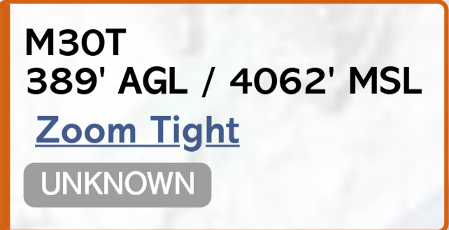
This is the small rectangular box adjacent to the aircraft selected. This box includes the aircraft type, altitude, classification (for more information about classifications, see Classify), and a ‘zoom tight’ hyperlink that, when selected, will automatically zoom in to the aircraft.
The Mini Flight Profile is a minimized information box
located on the left-hand side of the COP (Common Operating
Picture). It provides a quick summary of key flight and
aircraft data, including:
Additionally, the profile includes a Drone Card hyperlink,
shown as the name of the drone (e.g. Mavic 3)
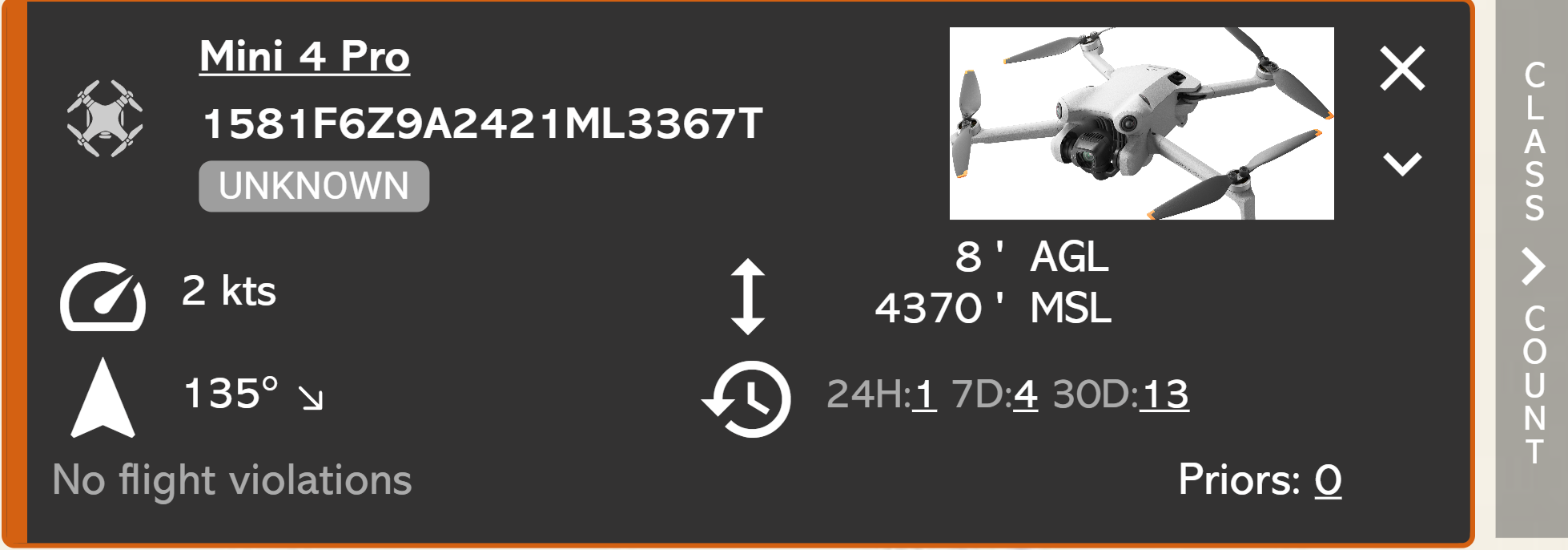
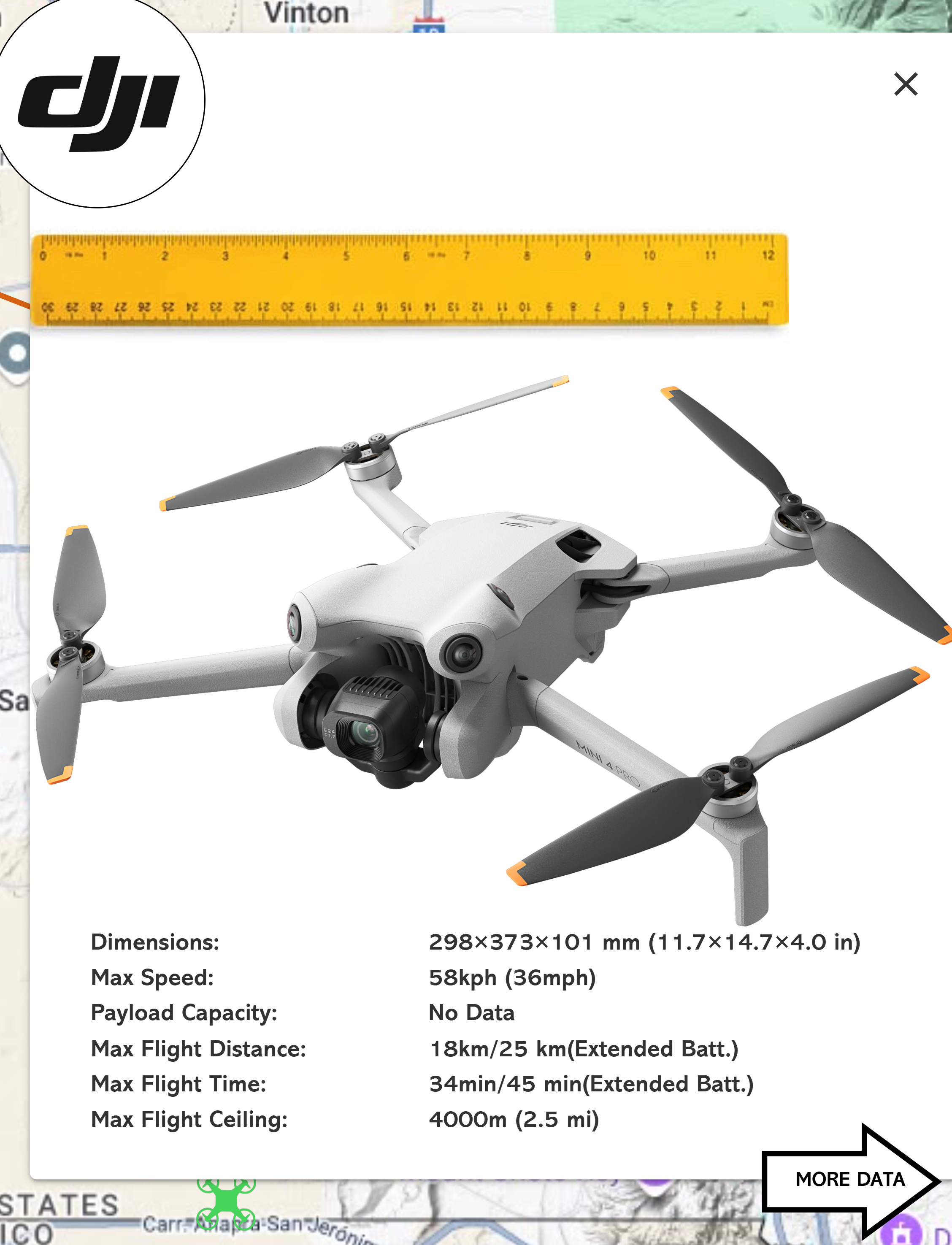
The Drone Card hyperlink appears as the drone name (e.g., Mavic 3). Clicking this hyperlink opens the Drone Card, which provides detailed technical information about the aircraft.
The initial view displays general specifications,
including:
- Dimensions
- Maximum Speed
- Payload Capacity
- Maximum Flight Distance
- Maximum Flight Time
- Maximum Flight Ceiling
- Communications Section
- Communication Protocols
- Global Navigation Satellite System (GNSS)
- Operating Frequency
- Transmission Range
- Camera and Storage Section
- EO Camera Capability
- EO Internal Storage
- EO Video Resolution
- EO Optical Zoom
- EO Digital Zoom
- EO Hybrid Zoom
- IR Camera Capability
- IR Video Resolution
- IR Optical Zoom
- IR Digital Zoom
- IR Hybrid Zoom
- Battery Section
- Battery Capacity
- Charging Time
- Features Section
- ADS-B Receiver
- Obstacle Sensors
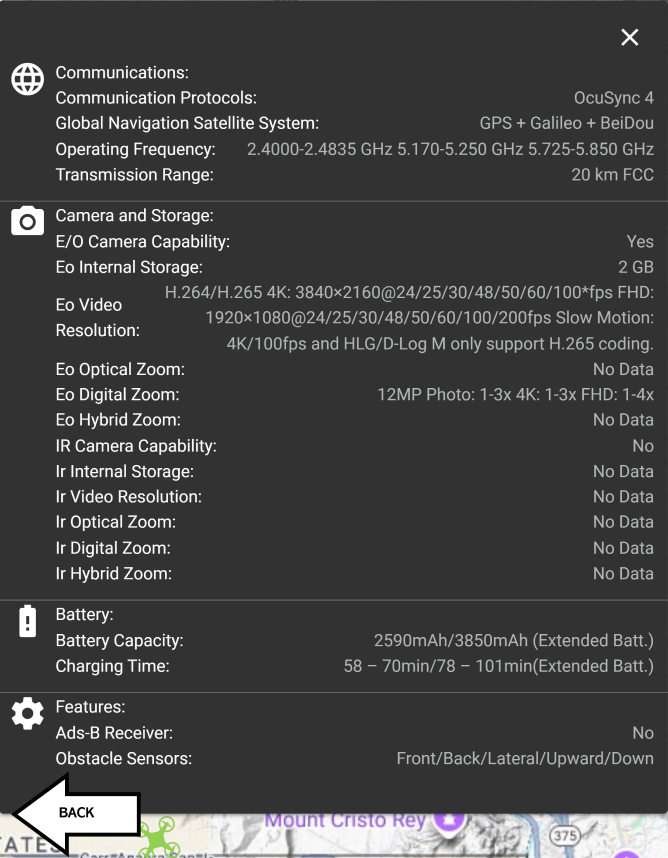
Users can click the back arrow to return from the extended
details view to the Basic Data portion of the Drone Card.
This
modular structure allows users to quickly assess critical
aircraft capabilities and technical specifications in real time
during monitoring or incident response.
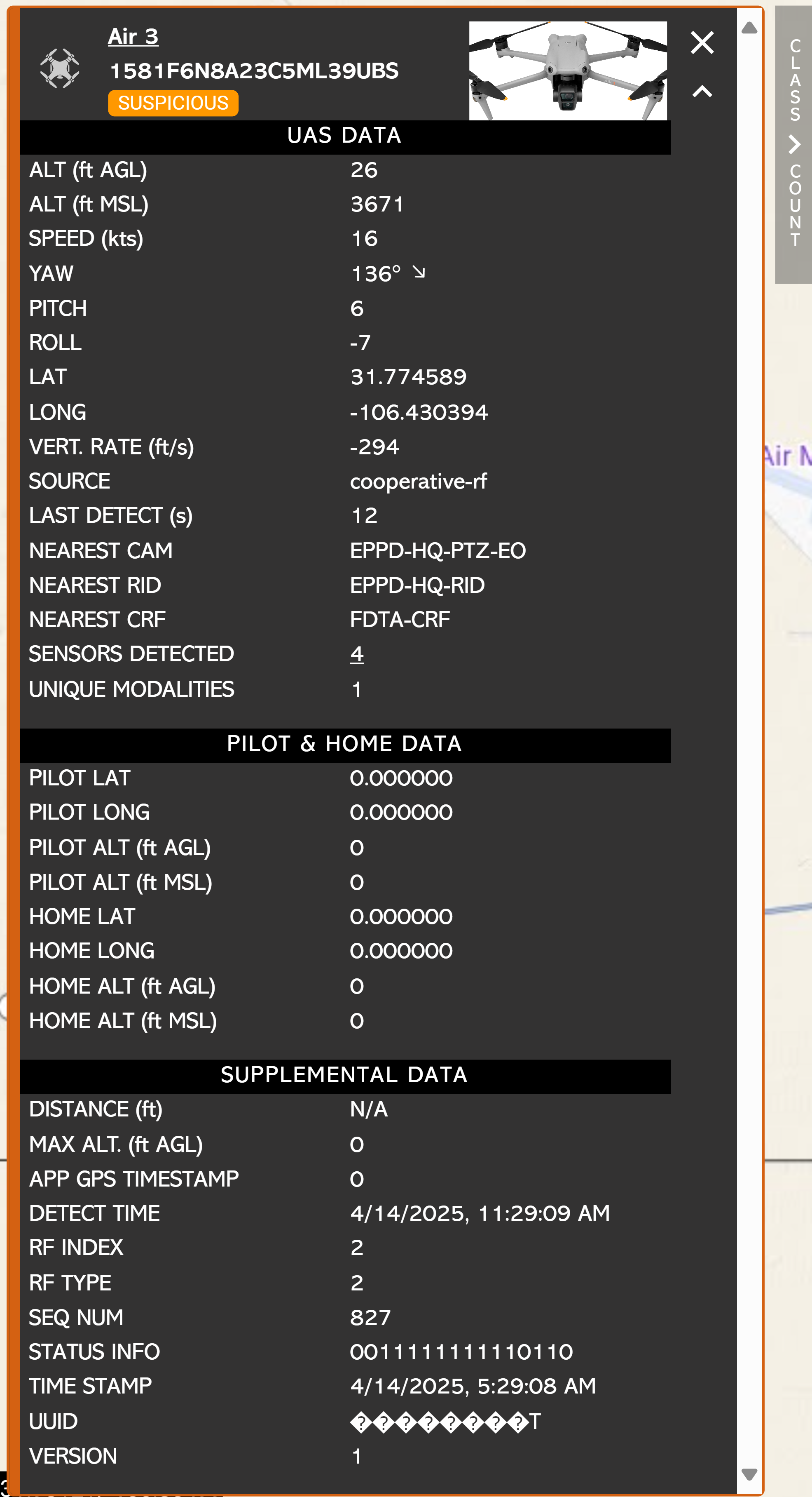
The Expanded Flight Profile is the maximized version of the Mini Flight Profile, located on the left-hand side of the COP (Common Operating Picture). It provides a detailed view of real-time and historical data related to the selected aircraft. This view is essential for situational awareness and further analysis during flight operations or incident investigation.
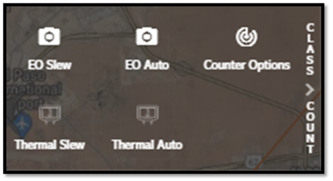
The ‘Class & Count’ option is located to the right of both the mini and expanded Flight profile. In this menu option you can task integrated Pan-Tilt-Zoom (PTZ) cameras to slew to the aircraft or download a csv file to analyze flight data.
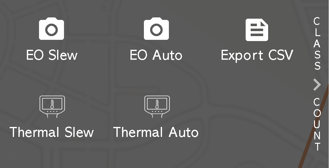
As a user with counter permissions, you can counter a potential UAS threat with integrated effectors within the ‘Class & Count’ option, located to the right of both the mini and expanded Flight profile.