Protected Airspace DAA
The Protected Airspace DAA tab displays all Key Sensitive Areas to Monitor within the UNIFY.C2 platform. It is organized into 10 categories:
- Detect and Avoid (DAA) Locations
- Airports
- Federal Agency Facilities
- Railroad Yards
- Telecom Infrastructure
- Utilities
- County Prison Facilities
- Federal Prison Facilities
- National Security Restrictions
- State Prison Facilities
Users can toggle individual categories and specific locations within each category on or off to control which areas are visually highlighted on the map. This supports customized airspace monitoring tailored to each user's area of responsibility (AOR).
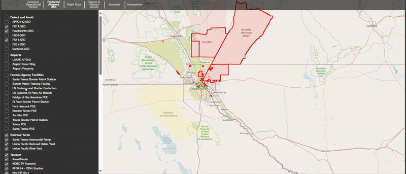
Each category in Protected Airspace DAA is directly linked to built-in System Alerts. These alerts automatically trigger when drone activity violates the defined parameters around these sensitive areas. The DAA tab gives users visual and toggle-based control over those same alert zones.
Alert Logic & Drone Behavior Indicators
Violations (Blink Orange):
When drones trigger one of these violation rules, they
will blink orange on the COP to draw operator
attention.
Possible Criminal Acts (Blink Red):
Drones triggering these high-severity zones will blink
red on the map, indicating a potential criminal offense
requiring immediate attention.