Swarm
Swarm allows users to simulate and monitor upcoming drone swarm flights. Users can upload a properly formatted CSV file, and if the data is valid, each flight will appear as a row in the main table for review and tracking.
- Note: Swarm flights will only appear in the Sandbox environment and are not shown in the production map. This feature is intended for testing and simulation purposes only.
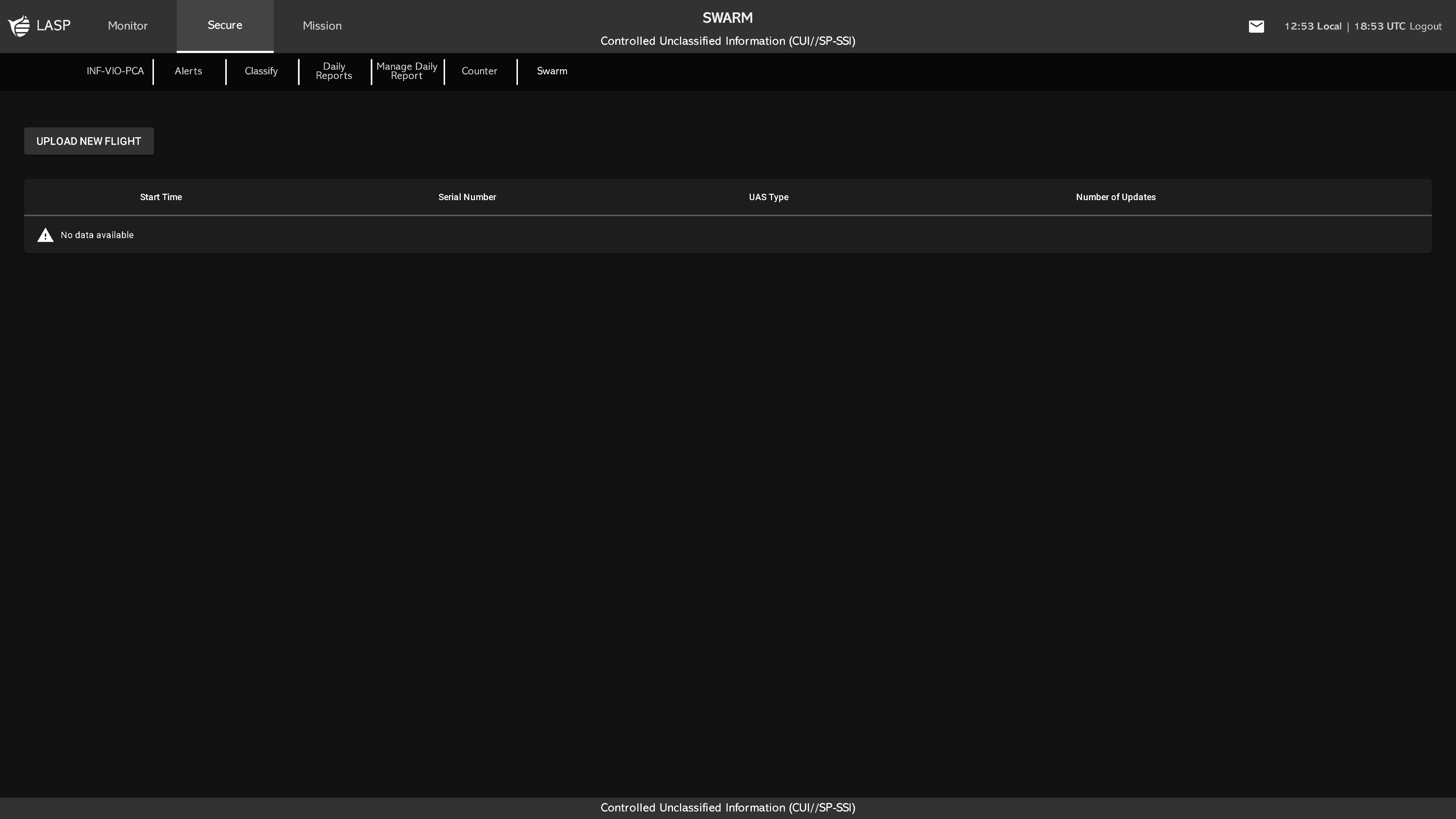
Uploading Swarm Flights
To add swarm flight data:
- Prepare a CSV file using the required format (see below).
- Ensure the first column contains Unix timestamps (in seconds, GMT).
- Upload the CSV file to the Swarm tab.
- Valid swarm flights will populate the table upon upload.
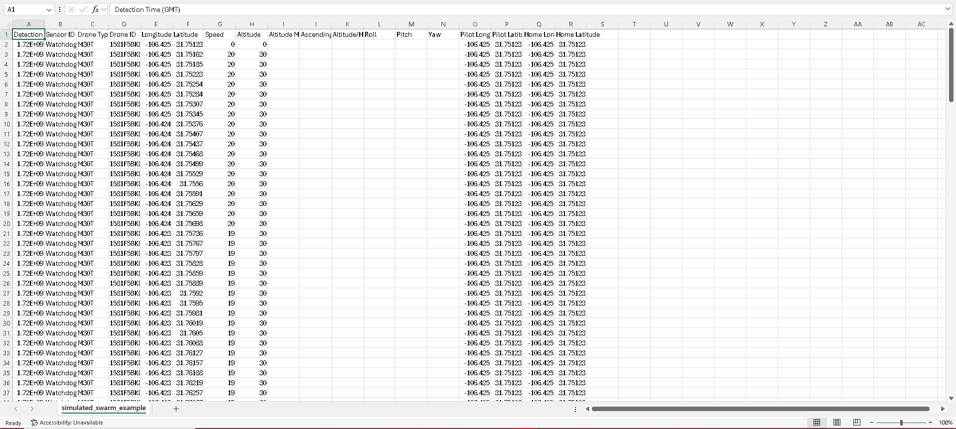
CSV Format (Required Column Order)

- Detection Time (GMT)
- Sensor ID
- Drone Type
- Drone ID
- Longitude
- Latitude
- Speed
- Altitude
- Altitude MSL
- Ascending Speed
- Altitude/Height
- Roll
- Pitch
- Yaw
- Pilot Longitude
- Pilot Latitude
- Home Longitude
- Home Latitude